Coast · 10 October 2026
The Town I call Home
Peterhead: The Bloo Toon, Viking History and Hidden Aberdeenshire
Discover Peterhead’s remarkable maritime history, Norse connections and forgotten harbours through the eyes of a local North East Scotland tour guide.
By Jamie Robertson | Scotland – A Path Less Known Tours
A Town Built Upon the North Sea
The North Sea.
The very lifeblood of Scotland.
A vast and often unforgiving expanse of water, rich in natural harvest. Fishing, oil and gas, renewable energy and nature herself — for centuries, these waters have provided both opportunity and danger to the communities living along our eastern shores.
Entire towns have built their fortunes upon the sea.
And perhaps none more so than Peterhead — the Bloo Toon.
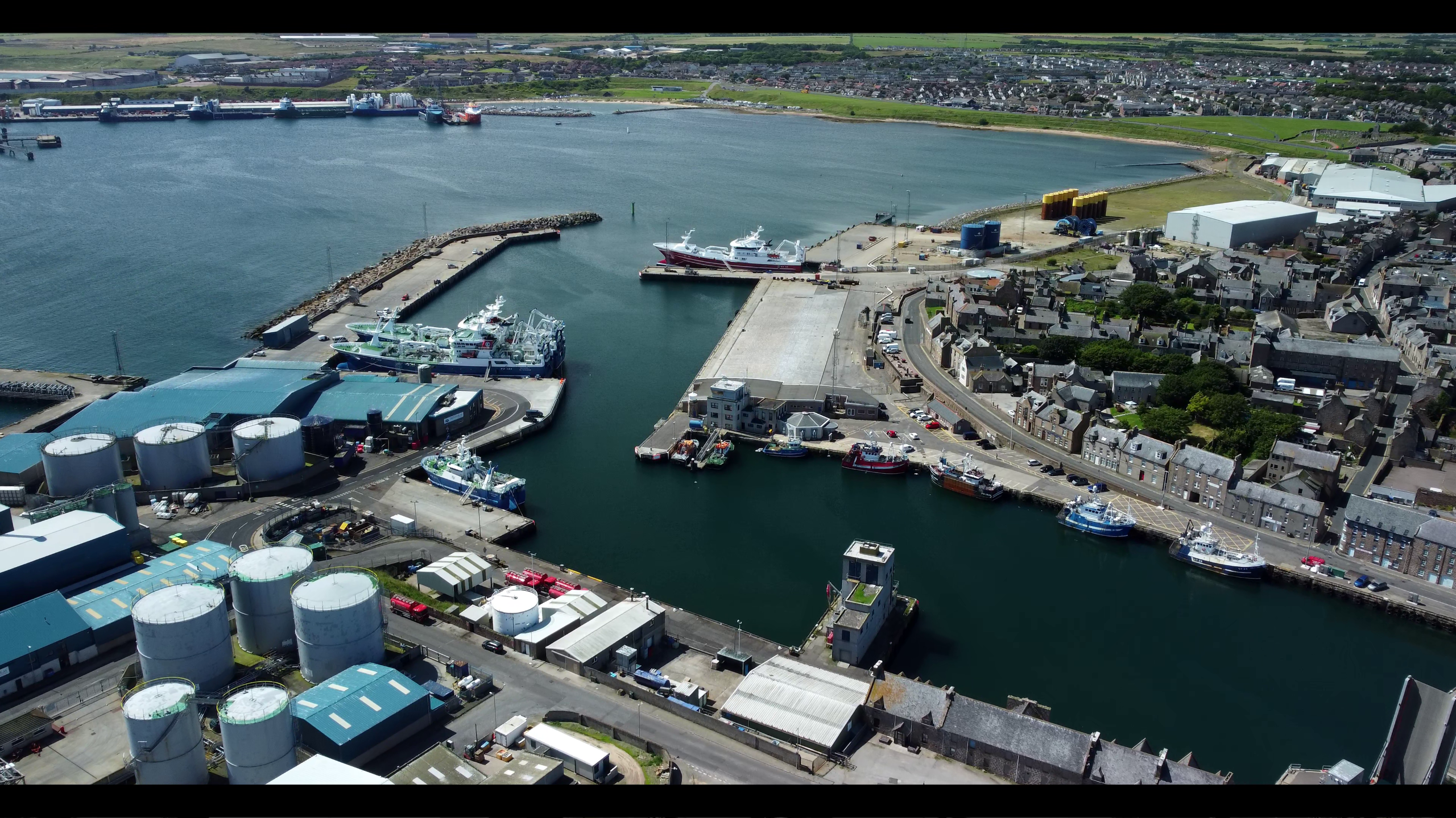
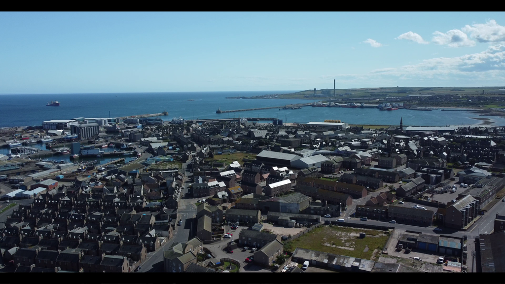
Nestled roughly 30 miles north of Aberdeen, at Scotland’s most easterly point, Peterhead sits between the sprawling sands of Craigewan to the north and the dramatic granite cliffs of Buchan to the south.
It is Aberdeenshire’s largest town, with a population of around 19,000.
But Peterhead is far more than a collection of streets, houses and harbours.
It is a place built upon centuries of seafaring, trade, conflict and extraordinary change.
A shipbuilding centre. A whaling port. A granite exporter. A Victorian spa resort. A defender against pirates, smugglers and wartime threats.
And, of course, one of Europe’s great fishing ports.
For visitors exploring the North East of Scotland, Peterhead offers a fascinating insight into a side of Aberdeenshire that often goes unnoticed.
Many people travelling north from Aberdeen head straight for the famous castles and coastal viewpoints. Yet the towns and communities along the Buchan Coast have stories every bit as remarkable.
To understand Peterhead properly, though, we need to go back much further than the modern harbour.
Much further, in fact, than most folk might imagine.
The Fishing Capital of Britain
Peterhead’s relationship with the sea has never been a casual one.
Fishing has shaped the town’s identity, its economy, its families and its character for generations.
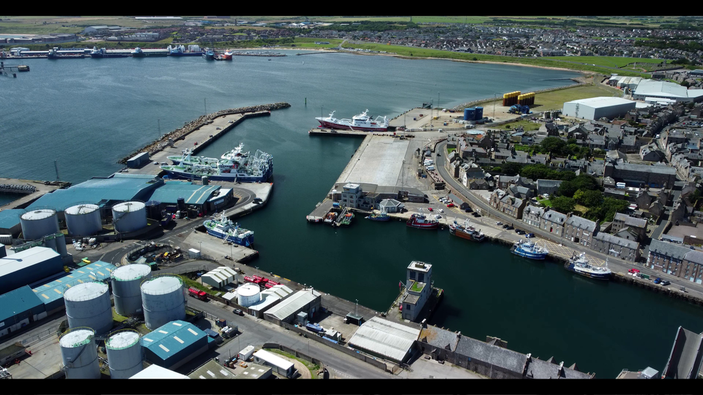
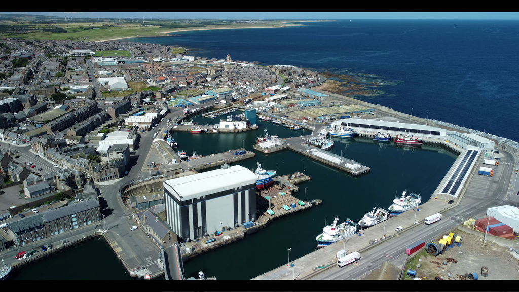
Today, the harbour remains one of Europe’s most important fishing centres, while the wider port has also played a significant role in supporting the North Sea oil and gas industry.
More recently, renewable energy has joined the story.
Just offshore lies Hywind Scotland, the pioneering floating offshore wind farm, its five enormous turbines rising above the North Sea.
Think about that for a moment.
A coastline once frequented by Viking longships would, many centuries later, support fishing fleets, oil-industry vessels and some of the world’s most advanced offshore energy technology.
Different centuries. Different industries.
But always the sea.
And always Peterhead.
This living maritime heritage is one of the reasons I love showing visitors the Buchan Coast on my private tours from Aberdeen. There’s always another layer of history waiting to be uncovered.
Before There Was a Bloo Toon
Now, here’s where the story becomes particularly interesting.
Long before Peterhead became the bustling seaport we know today, this stretch of coastline would have looked very different.
At the close of the sixth century, when early Christian communities were developing around places such as Aberdour and Deer, the rocky headland on which Peterhead would eventually rise lay somewhat apart from the principal routes running north and south.
Imagine the scene.
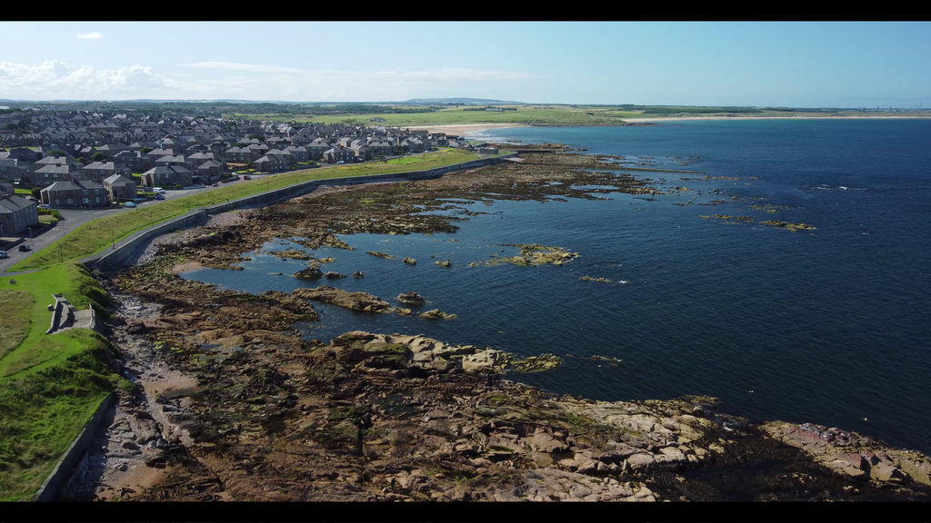
A lonely stretch of coastline, surrounded by restless water, marshland and exposed rock.
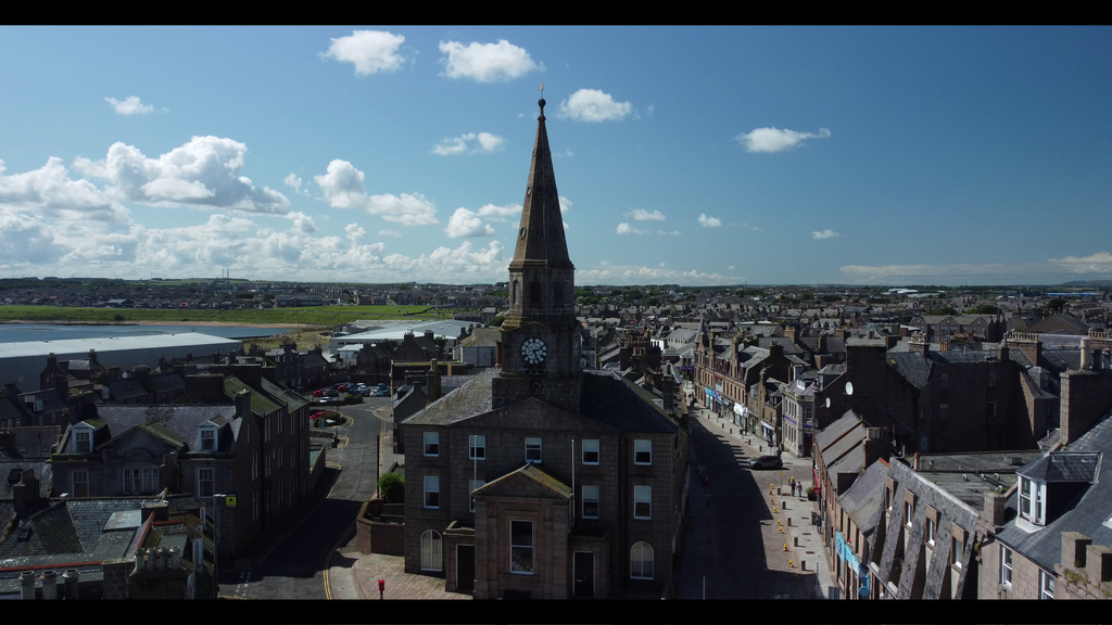
Where the modern town centre stands today, a rounded hill rose from the surrounding ground. Its crest lay around the area now occupied by Chapel Street and the Town House.
That hill was once higher than it appears today, having been lowered during the town’s development.
Off the eastern edge of the mainland stood Keith Inch, an island of roughly nine acres, now incorporated into the southern harbour headland.
Further north lay Greenhill, another low-lying island, covering a little over four acres.
These features helped give the coastline its distinctive shape.
But they did not necessarily make it a welcoming place to settle.
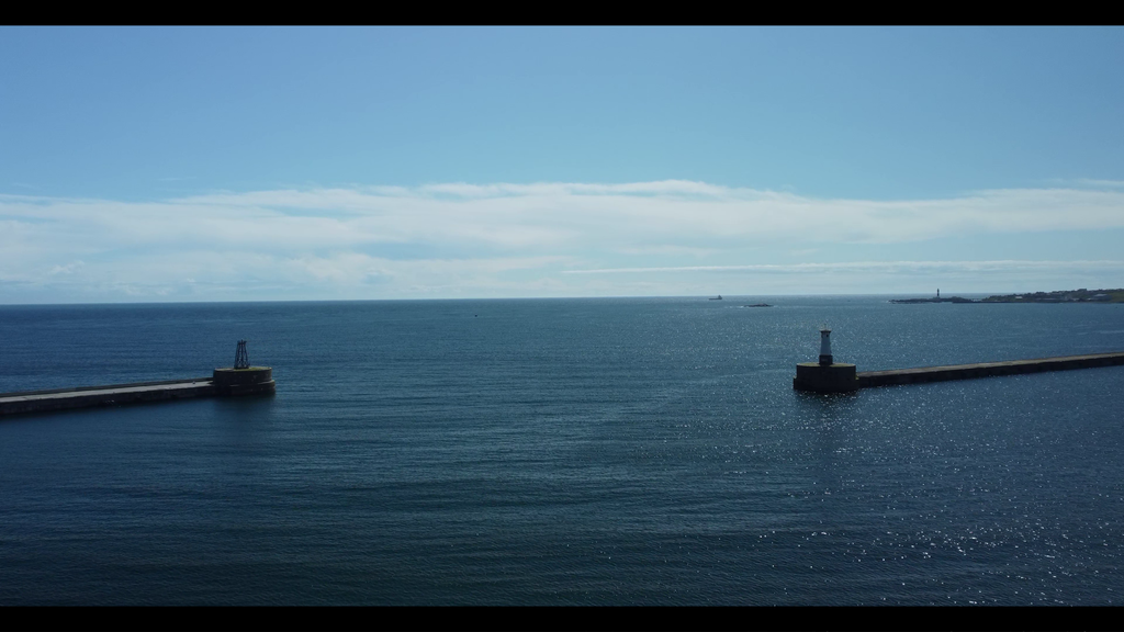
Unlike towns founded beside sheltered estuaries or tranquil inland bays, early Peterhead faced the full fury of the North Sea.
Without today’s substantial breakwaters, this would have been a rugged, exposed and formidable location.
And yet, hidden within that difficult geography lay the seeds of Peterhead’s future.
The Vikings Arrive in Buchan
Take a glance at a map of the North Sea.
You’ll notice something fascinating.
Peterhead lies among the closest parts of the Scottish mainland to the long coastline of Norway.
And during the ninth and tenth centuries, Norway had become one of Europe’s great maritime powers.
The Norsemen knew these waters.
They knew the value of a sheltered landing place, the importance of a navigable coastline and the opportunities offered by settlements accessible from the sea.
While religious communities flourished further inland in Buchan, the eastern coastline was exposed to the movements of Viking seafarers.
Their arrival would leave traces across the region — in its history, traditions and, perhaps most visibly, its place names.
For seafarers searching for a foothold on Scotland’s north-eastern coast, this rocky corner of Buchan offered access to the fertile lands beyond.
A coastal base could become a gateway inland.
And through that connection with the Norse world, we begin to uncover some of the earliest chapters in Peterhead’s story.
As someone from Peterhead myself, there’s something rather remarkable about imagining those early vessels approaching the coastline.
The same stretch of North Sea we look out upon today.
The same winds.
The same relentless waves.
Only the vessels — and the centuries — have changed.
These are the kinds of stories I enjoy sharing during my guided tours of Aberdeenshire. The landscape is beautiful enough on its own, but understanding what happened here can completely change how you see it.
A Norse Echo in the Doric Tongue
Now, here’s something close to my heart.
I’m a Peterheader.
And like many folk from this corner of Scotland, I grew up surrounded by Doric, our distinctive North East form of Scots.
It’s part of who we are.
The rhythms, expressions and words of Doric carry the history of this region, passed from generation to generation.
And among the influences sometimes proposed for our local speech are connections with the Scandinavian languages brought across the North Sea.
The precise linguistic history is more complicated than any single explanation, but the possibility of those old connections is fascinating.
Because the people who crossed these waters didn’t simply arrive and disappear without a trace.
Their influence forms part of the wider story of the North East.
And nowhere is that more intriguing than in the names of the places around us.
The Ancient Names of Buchan
Travel around the Buchan coastline and you’ll encounter names that have inspired generations of local historians to search for their origins.
Buchanhaven, for example, has been associated with an interpretation of the Norse Bugtenhaven — a harbour connected with a bay or bight.
Buchan Ness has similarly been linked in local historical explanations with the idea of a headland or point.
And then there’s Keith Inch, whose name invites its own questions about the island’s past and its later connections with the powerful Keith family.
Further around Peterhead, traditional explanations have been offered for names such as the Ronheads, Geddle Braes and the Ive.
The interpretations recorded in older local histories connect these places with descriptions of the landscape — rounded slopes, goats and enclosed or defined land.
The Queenie, too, has been associated with the meeting of waters.
Nearby Boddam has been given a proposed Scandinavian interpretation, while the Bullers o’ Buchan has sometimes been connected with an old name suggesting noise or uproar.
And if you’ve ever visited the Bullers when the seabird colonies are in full voice, you’ll appreciate just how appropriate that description feels!
Thousands of birds calling from the cliffs, their cries echoing around the great natural amphitheatre.
It’s a sound you don’t easily forget.
These traditional interpretations are fascinating clues, although place-name origins can be disputed, and not every proposed Norse connection is established fact.
Nevertheless, they remind us that familiar names can carry remarkable stories.
Places we pass without a second thought may hold echoes of centuries long gone.
For anyone planning a trip to Aberdeen and Aberdeenshire, the coast north of the city is well worth exploring. From Buchan Ness to the Bullers o’ Buchan, this landscape brings together extraordinary scenery, wildlife and centuries of local history.
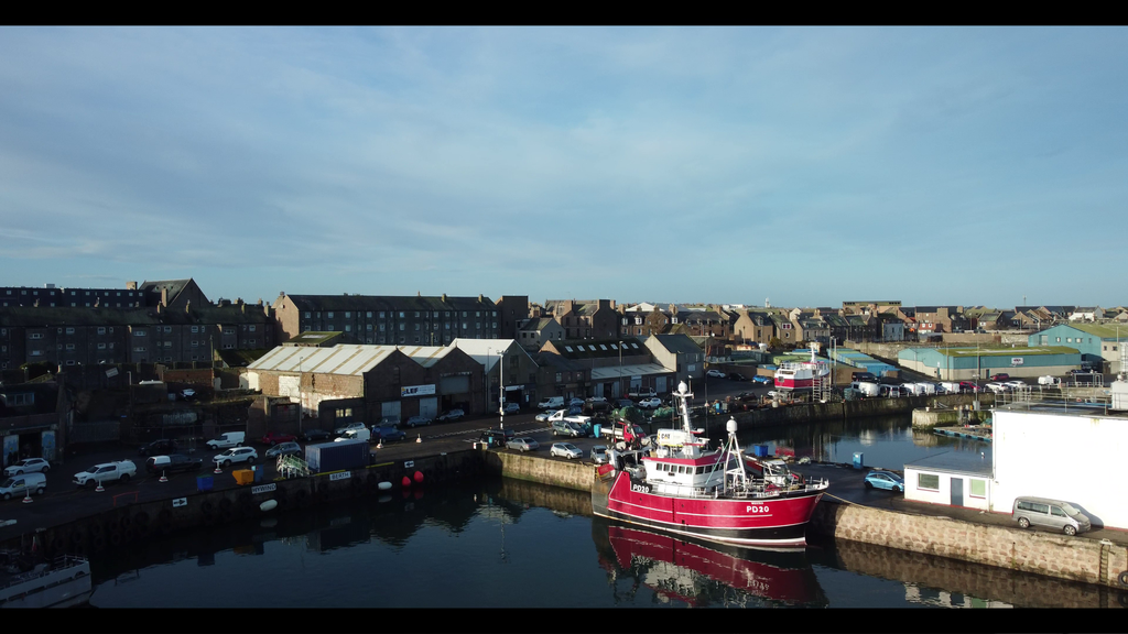
Almanythie: Peterhead’s Forgotten Harbour
Of all the names associated with Peterhead’s earliest maritime history, one particularly interests me.
Almanythie.
Today, it may not be a name known to every visitor to the town.
But its story takes us back towards the very beginnings of Peterhead’s relationship with the sea.
The Almanythie Rocks have long been associated with an ancient landing place, sometimes described in local historical accounts as the remains of an early artificial harbour.
Older interpretations of the name have suggested a Scandinavian connection relating to public or common use.
Imagine what such a harbour might once have looked like.
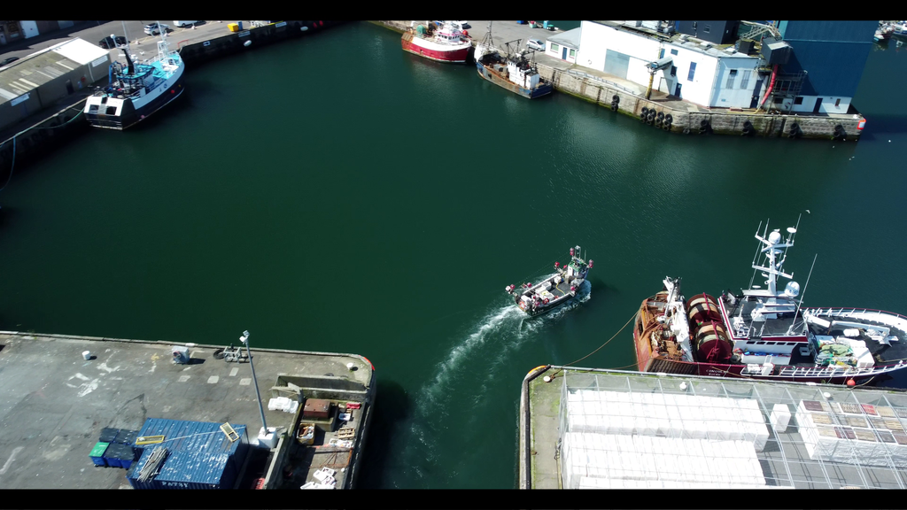
Not the vast modern complex filled with trawlers, supply vessels and commercial shipping.
Something far simpler.
A modest place where a vessel might find shelter during worsening weather.
A landing point.
Somewhere to bring a boat ashore when the North Sea became too dangerous.
For the earliest seafarers, a harbour was not necessarily a great trading centre.
Its first and most important purpose could be survival.
A shelter in time of storm.
And what a powerful thought that is.
The immense harbour we know today may have developed over many centuries, but the need behind it was already understood by those early coastal communities.
Find shelter.
Protect the vessel.
Get safely ashore.
Everything else could follow.
From Ancient Shelter to Great Seaport
As the centuries passed, the old landing places were gradually superseded.
Buchanhaven retained its own maritime identity, while Peterhead’s inhabitants increasingly developed and improved the harbours that would sustain the growing town.
Fishing became central to that prosperity.
But Peterhead’s maritime story would eventually extend far beyond fishing alone.
In time, its harbours would see barrels of herring, sealskins, whalebone, granite and vessels connected to the search for North Sea oil.
Who could have imagined such a future while standing beside one of those early rocky landing places?
A harbour that began as a refuge would become the foundation of an extraordinary maritime town.
And yet, there’s another place we must visit before our journey into Peterhead’s earliest history can continue.
A place that provided something just as essential to settlement as shelter from the sea.
Fresh water.
The River Ugie: The Water That Sustained a Settlement
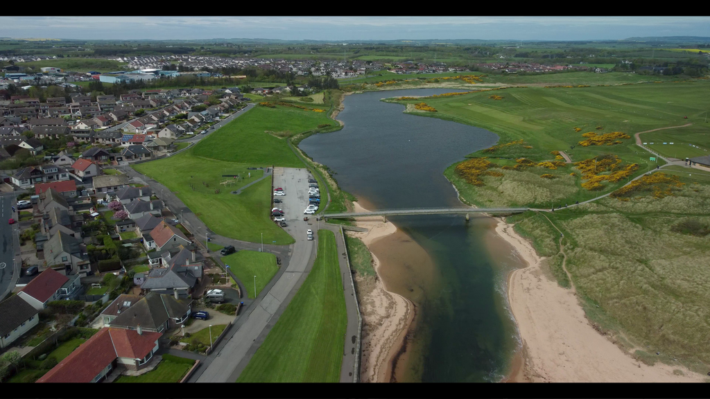
To the north of Peterhead flows the River Ugie.
Its name has been connected in local historical explanations with Gaelic words for water — a wonderfully simple name for a river of such importance.
For the people who settled in this part of Buchan, the river would have offered a valuable source of fresh water.
And where there is water, there is the potential for settlement.
Over time, communities, buildings and castles developed along its course.
The name Inverugie itself points towards the river’s mouth.
But the landscape surrounding the Ugie has not remained unchanged.
Historical accounts describe a river and surrounding environment different from those we see today, with changes to the local woodland and land use altering the landscape over many generations.
Much of Aberdeenshire was once considerably more wooded than the country we know now.
Try to picture that older Buchan.
The coastline exposed to the North Sea.
The River Ugie winding through a landscape of woodland and open ground.
Early communities living beside the water.
And beyond them, the beginnings of a town that would one day become one of the most significant ports in Britain.
There’s a great deal more to uncover.
And we’ve barely scratched the surface.
A Different Way of Seeing Peterhead
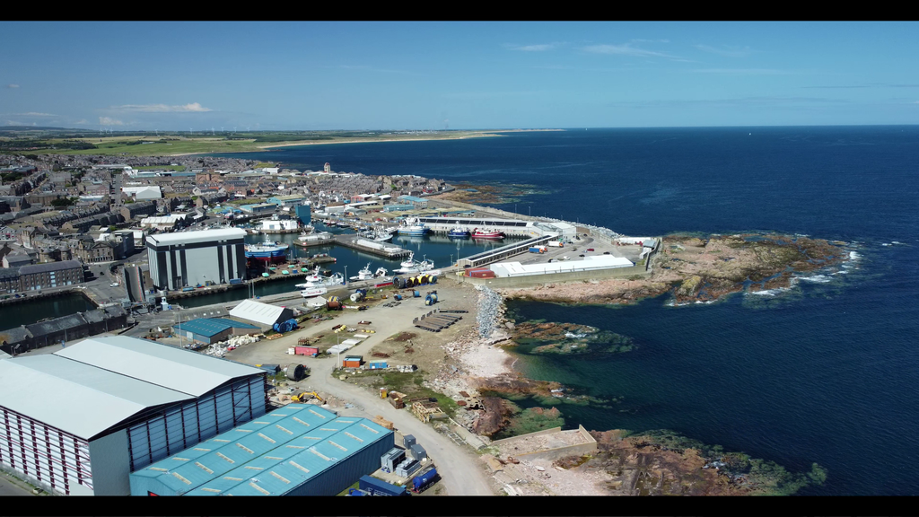
The next time you find yourself looking across Peterhead Harbour, take a moment.
Look beyond the fishing vessels, the modern quays and the breakwaters.
Think about the coastline before the town existed.
The rocky islands.
The ancient landing places.
The Norse seafarers crossing the North Sea.
The people who settled beside the River Ugie.
And the generations who would transform this exposed corner of Buchan into the Bloo Toon we know today.
Because Peterhead is much more than a fishing port.
It’s a place with stories carved into its rocks, carried across its waters and preserved in the names we still use.
And for me, that’s what makes exploring the North East of Scotland so fascinating.
Sometimes the most remarkable history isn’t hidden away in a grand castle or a museum.
Sometimes it’s right there, beneath your feet, in the town you’ve known all your life.
And this is only the beginning of Peterhead’s story.
Discover the Real Aberdeenshire with a Local Guide
If this glimpse into Peterhead’s history has sparked your curiosity, there’s a whole coastline waiting to be explored.
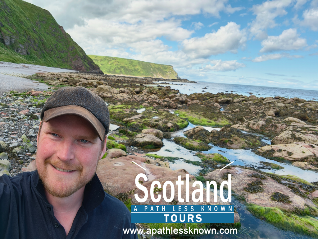
I’m Jamie Robertson, a local guide and the face behind Scotland – A Path Less Known Tours.
I offer private guided tours from Aberdeen, exploring the castles, coastlines, historic villages and lesser-known places that make North East Scotland so special.
My Buchan Coast Tour is an opportunity to discover the dramatic scenery and fascinating heritage of this remarkable part of Aberdeenshire, with local stories and insights you won’t necessarily find in a conventional guidebook.
Whether you’re visiting Aberdeen for the first time, returning to explore more of Scotland or simply keen to discover somewhere different, I’d love to show you around.
Explore my Buchan Coast Tour or get in touch to discuss a private Aberdeenshire tour.
Because sometimes the best way to experience Scotland is to take a path less known.
This article is adapted from Part One of my original Peterhead history film. Several traditional place-name interpretations and early historical accounts are presented as local historical traditions rather than established conclusions.
Watch the original film: Peterhead — Scotland, A Path Less Known